Property Record
4505 Best Rd, Atlanta, GA 30337


NEARBY LISTINGS FOR SALE OR LEASE
Property Detail
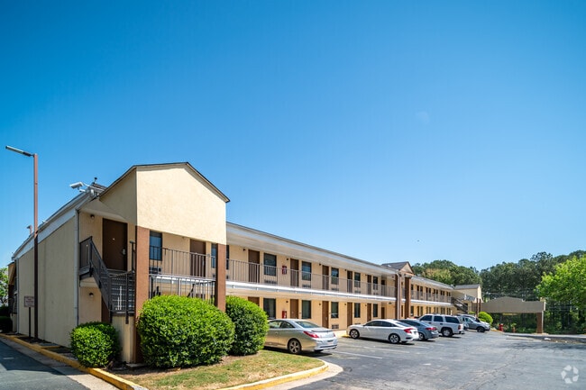
4505 Best Rd
13-0037-LL-072-0
Prepared Kns Hospitality Llc
Motel
Fulton
X
Georgia
13121C0364F
28
2024
3.11 AC
2025
Atlanta Airport
010603
Atlanta
55,240 SF
Atlanta-Sandy Springs-Roswell, GA
DEMOGRAPHICS near 4505 Best Rd
1 Mile
3 Mile
5 Mile
2024 Total Population
1,361
58,286
170,643
2029 Population
1,409
60,255
175,246
Pop Growth 2024-2029
+ 3.53%
+ 3.38%
+ 2.70%
Average Age
40
36
37
2024 Total Households
595
23,428
68,796
HH Growth 2024-2029
+ 3.36%
+ 3.31%
+ 2.72%
Median Household Inc
$36,571
$44,584
$49,032
Avg Household Size
2.20
2.40
2.40
2024 Avg HH Vehicles
1.00
1.00
1.00
Median Home Value
$175,509
$190,920
$182,316
Median Year Built
1973
1976
1978
Nearby Places
Map Layers
Map Styles
 Street
 Aerial
- Restaurants
- Banks
- Shops
- Fitness
- Groceries
PUBLIC TRANSPORTATION
AIRPORT
Hartsfield - Jackson Atlanta International
DRIVE
WALK
Distance
Hartsfield - Jackson Atlanta International
13 min
6.9 mi
Freight Ports
Georgia Ports - Savannah
DRIVE
WALK
Distance
Georgia Ports - Savannah
276 min
244.0 mi
SALE & LEASE HISTORY
LISTING DATE
SALE/LEASE

Nov 12, 2024
For Sale
Jul 17, 2017
For Sale
Nearby Properties
Address
Land Use
TOTAL SIZE
Lot Size
Zoning
Address
Land Use
TOTAL SIZE
Lot Size
Zoning
116,750 SF
997.24 AC
HI
Address
Land Use
TOTAL SIZE
Lot Size
Zoning
880,465 SF
130.34 AC
C
Address
Land Use
TOTAL SIZE
Lot Size
Zoning
63,992 SF
174.80 AC
HI
Address
Land Use
TOTAL SIZE
Lot Size
Zoning
200,000 SF
34.20 AC
HI
Address
Land Use
TOTAL SIZE
Lot Size
Zoning
274.75 AC
HI
Address
Land Use
TOTAL SIZE
Lot Size
Zoning
28,000 SF
246.83 AC
I
Address
Land Use
TOTAL SIZE
Lot Size
Zoning
104.17 AC
C
Address
Land Use
TOTAL SIZE
Lot Size
Zoning
965,840 SF
1.50 AC
C
Address
Land Use
TOTAL SIZE
Lot Size
Zoning
2,666 SF
46.88 AC
BP
Address
Land Use
TOTAL SIZE
Lot Size
Zoning
229.84 AC
HI
Address
Land Use
TOTAL SIZE
Lot Size
Zoning
198.66 AC
I
Address
Land Use
TOTAL SIZE
Lot Size
Zoning
2,666 SF
0.43 AC
Address
Land Use
TOTAL SIZE
Lot Size
Zoning
2,666 SF
0.43 AC
Address
Land Use
TOTAL SIZE
Lot Size
Zoning
2,666 SF
0.43 AC
Address
Land Use
TOTAL SIZE
Lot Size
Zoning
2,666 SF
0.43 AC
Address
Land Use
TOTAL SIZE
Lot Size
Zoning
2,666 SF
0.43 AC
Address
Land Use
TOTAL SIZE
Lot Size
Zoning
2,666 SF
0.43 AC
Address
Land Use
TOTAL SIZE
Lot Size
Zoning
2,666 SF
0.43 AC
Address
Land Use
TOTAL SIZE
Lot Size
Zoning
2,666 SF
0.43 AC
Address
Land Use
TOTAL SIZE
Lot Size
Zoning
2,666 SF
0.43 AC
Address
Land Use
TOTAL SIZE
Lot Size
Zoning
2,666 SF
0.43 AC
Address
Land Use
TOTAL SIZE
Lot Size
Zoning
293,211 SF
23.51 AC
C
Address
Land Use
TOTAL SIZE
Lot Size
Zoning
65,458 SF
174.39 AC
C1
Address
Land Use
TOTAL SIZE
Lot Size
Zoning
270,503 SF
4.56 AC
C
Address
Land Use
TOTAL SIZE
Lot Size
Zoning
2,059,074 SF
13.91 AC
R3
Address
Land Use
TOTAL SIZE
Lot Size
Zoning
386,354 SF
10.03 AC
CR
Address
Land Use
TOTAL SIZE
Lot Size
Zoning
196,294 SF
0.49 AC
R1
Address
Land Use
TOTAL SIZE
Lot Size
Zoning
113,364 SF
2.19 AC
I
Address
Land Use
TOTAL SIZE
Lot Size
Zoning
115.30 AC
I
Address
Land Use
TOTAL SIZE
Lot Size
Zoning
6,402,340 SF
22.62 AC
MF
The World's #1 Commercial Real Estate Marketplace
Connect with us
© 2026 CoStar Group
The information above has been obtained from sources believed reliable. While we do not doubt its accuracy we have not verified it and make no guarantee, warranty or representation about it. It is your responsibility to independently confirm its accuracy and completeness. Any projections, opinions, assumptions, or estimates used are for example only and do not represent the current or future performance of the property. The value of this transaction to you depends on tax and other factors which should be evaluated by your tax, financial, and legal advisors. You and your advisors should conduct a careful, independent investigation of the property to determine to your satisfaction the suitability of the property for your needs.